
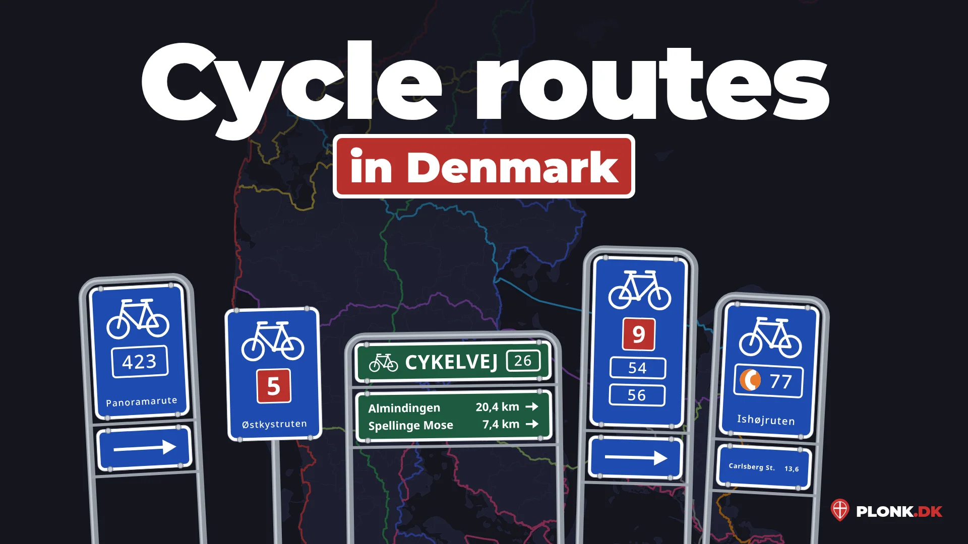
In Denmark, you will often see signs for cycle routes. These are small blue square signs with a white border. At the top is a white bike, and below it the route’s number in a red or blue box. Many signs have the route’s name at the bottom in white text, such as a town or region the route is named after, and the panorama routes often have the word Panoramarute. Other signs only have the number, and some have a plate with distances to nearby towns. On Bornholm the signs are green; see the section on Bornholm.
It is common for several routes to share a stretch of road, and then they are on the same sign.
- Red box: one of the 11 long national routes.
- Blue box: a regional route or a panorama route. There are many more of these.
Unlike Denmark’s numbered roads, the cycle routes don’t show up on the map in GeoGuessr, so you need to learn them for them to be useful. The national routes and the panorama routes are fairly easy to learn, and well worth it. The regional routes are a different story: there are many more of them, and they are not as ordered. They are only worth learning if you want to dive really deep into Denmark.
The national routes
Denmark’s 11 national cycle routes have the red box on the sign. Their numbers follow a system, so they are easy to remember:
- The odd numbers, 1, 3, 5, 7 and 9, go from north to south.
- 2, 4 and 6 go from west to east, and all end in Copenhagen.
- 8, 10 and 12 go in a loop around a certain area.
| Route | On the map | Name | From – to |
|---|---|---|---|
| 1 | Vestkystruten (the West Coast Route) | Rudbøl – Skagen, along Jutland’s west coast | |
| 3 | Hærvejsruten (the Army Road Route) | Padborg – Frederikshavn, mostly along the old Hærvejen | |
| 5 | Østkystruten (the East Coast Route) | Sønderborg – Skagen, along Jutland’s east coast | |
| 7 | Sjællands Odde – Rødby | ||
| 9 | Helsingør – Gedser | ||
| 2 | Hanstholm – Copenhagen | ||
| 4 | Søndervig – Copenhagen | ||
| 6 | Esbjerg – Copenhagen | ||
| 8 | Østersøruten (the Baltic Sea Route) | Around southern Denmark | |
| 10 | Bornholm Rundt (Tour of Bornholm) | Around Bornholm | |
| 12 | Limfjordsruten (the Limfjord Route) | Around the Limfjord |
The colours are only on the maps here, to tell the routes apart. On the signs, the box is always red.
Watch out for low numbers in Jutland: several regional routes have the same numbers as the national ones, such as 2, 4, 7 and 9. Only the colour of the box tells them apart, so a 9 in a blue box is a regional route, not national route 9.
From Rudbøl in south-west Jutland along the whole west coast to Skagen, the northernmost point of Denmark.
From Hanstholm in north-west Jutland to Copenhagen.
From Padborg on the German border to Frederikshavn. Named after the old road Hærvejen, which it follows most of the way.
From Søndervig on Jutland’s west coast to Copenhagen.
From Sønderborg in south-east Jutland along the east coast to Skagen.
From Esbjerg on Jutland’s west coast to Copenhagen.
From Sjællands Odde in north-west Zealand to Rødby on Lolland.
Around southern Denmark. It is easy to remember, as it forms an 8.
From Helsingør in north-east Zealand to Gedser on Falster, the southernmost point of Denmark.
Around the island of Bornholm.
Around the Limfjord in North Jutland.
The panorama routes
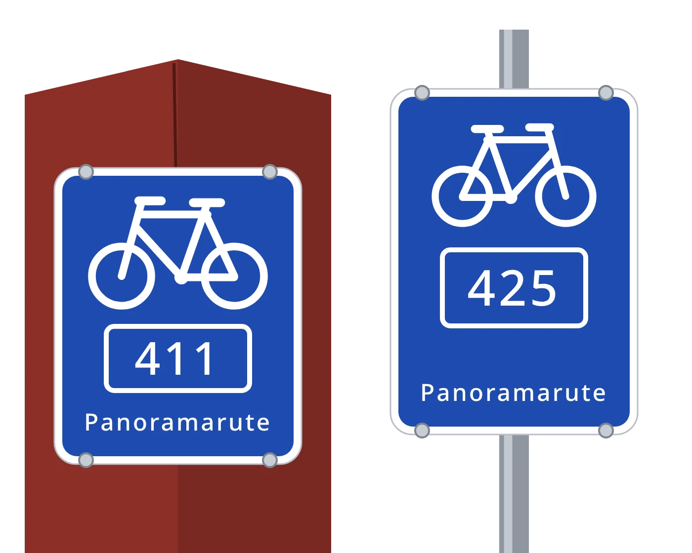
The panorama routes have the blue box and numbers in the 400s. The numbers run in order around the country, so the number alone tells you roughly where you are.
401–416: Jutland’s west coast
Routes 401–416 run along Jutland’s west coast from south to north. 401 is the southernmost, and parts of it are in Germany. 416 is around Ålbæk, just south of Skagen.
Just remembering this system works all right: 408 is about halfway up. If you want to be more precise, you can learn all the routes, or a few as reference points that limit where the others are.
Around Ålbæk, just south of Skagen.
Parts of it are in Germany.
417–430: Falster, Møn and Zealand
Panorama routes 417–430 are on Falster, Møn and Zealand, from Gedser in the south to Stevns Klint and Roskilde. The numbers rise roughly northwards, but not quite as simply:
- 417–420 are on Falster, and the higher the number, the further north.
- 421 is on the easternmost point of Møn, and 422 and 423 are around Stege.
- 424–426 are on Zealand and follow the coast north-east: 424 near Præstø, 425 near Faxe and 426 near Store Heddinge.
- 430 is on its own, west of Roskilde. There is no 427–429.
West of Roskilde.
Near Store Heddinge.
Near Faxe.
Near Præstø.
Starts in Stege.
Starts in Stege.
The easternmost point of Møn.
Sundruten, from Nykøbing Falster via Guldborg to Sundby.
Local routes in West Zealand, not panorama routes.
Watch out for routes 440–447 in West Zealand, such as 440 Aastrup Klostersløjfen, 444 Værslevsløjfen and 447 Rørvigsløjfen. A blue sign with 440–447 is not a panorama route, even though it looks like one. They are local routes, between Kalundborg, Sorø, Holbæk and Odsherred. They are grey on the map. Panorama route signs often have the word Panoramarute below the number, where the local ones have the route’s name, but that line can be missing, for example when the sign shares a post with another route. So go by the number.
Supercykelstier
The Bicycle Highways (Danish: Supercykelstier) are mostly in and around Copenhagen, but also in some towns in Jutland. Their signs can be recognised by an orange circle with a white C before the number, such as C77.
It is the logo that is useful. Most Supercykelstier are in the Copenhagen area, so the individual numbers matter less.
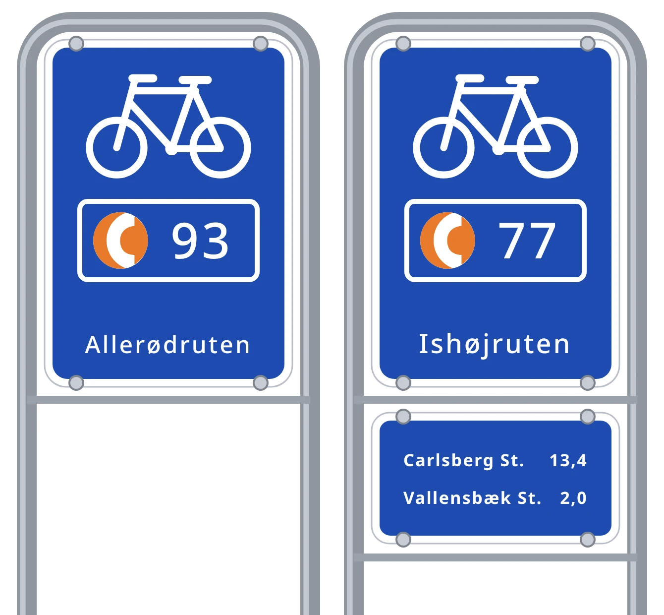
In Jutland, there are Supercykelstier in Aarhus, Vejle, Hedensted, Kolding and Esbjerg, among others. They have their own numbers, such as C40 Hedenstedruten, and the numbers can be the same as in Copenhagen: Aarhus has a C86 too, just like Ring 3-ruten. Ring 3-ruten is so new that it is not on Street View yet, so for now a C86 sign in GeoGuessr is in Aarhus.
C86 from Lisbjerg via Skejby to Aarhus H.
Bornholm
All the cycle routes on Bornholm are signposted with green signs instead of blue ones. At the top it says CYKELVEJ (“cycle path”) with the route number in a white frame, and a plate below gives destinations and distances. So a green cycle route sign is a strong hint for Bornholm.
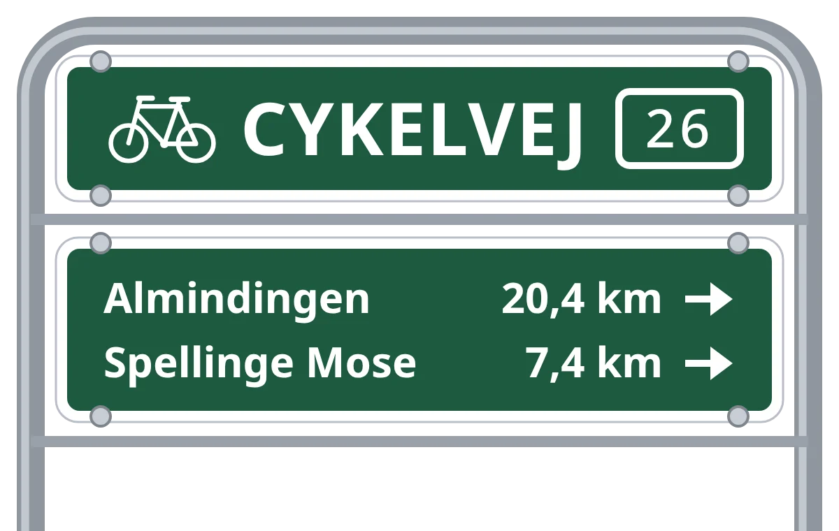
Besides national route 10, which goes around the coast, Bornholm has regional routes 21–26. Unlike the regional routes in the rest of the country, they follow a system:
- 21, 22 and 23 start in Rønne and head east. 21 crosses the south of the island to Nexø, 22 goes through the middle to Årsdale, and 23 goes up to the north coast at Helligdommen.
- 24, 25 and 26 run from south to north. 24 is a short link at Pedersker, 25 goes from Aakirkeby through Almindingen to Melsted, and 26 from Almindingen to Slotslyngen at the northern tip of the island.
The higher the number, the further north: 21 and 24 are in the south, 23 and 26 reach the north coast.
From Rønne across the south of the island to Nexø. Asphalt, mostly along an old railway line.
From Rønne through Almindingen and Paradisbakkerne to Årsdale. Mostly gravel.
From Rønne to Helligdommen on the north coast. Partly asphalt, partly gravel.
A short asphalt road at Pedersker between routes 10 and 21.
From Aakirkeby through Almindingen to Melsted near Gudhjem.
From Almindingen to Slotslyngen near Hammershus.
Around the island along the coast.
The regional routes
The regional routes are the least useful, since they are the hardest to remember. There is some correlation between the numbers and where the routes are, but it is not 100%, and there are a lot of exceptions. The same number can even show up in different places.
Here are the numbers in each part of the country.
| Area | Routes |
|---|---|
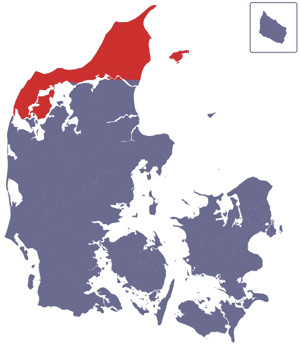 North of the Limfjord |
West to east: 24 17 19 56 52 23 59 63 60 62 61 17 and 24 continue south of the Limfjord, 19 is on Mors, and 23 goes around the Limfjord from Aggersund to Hals and back. |
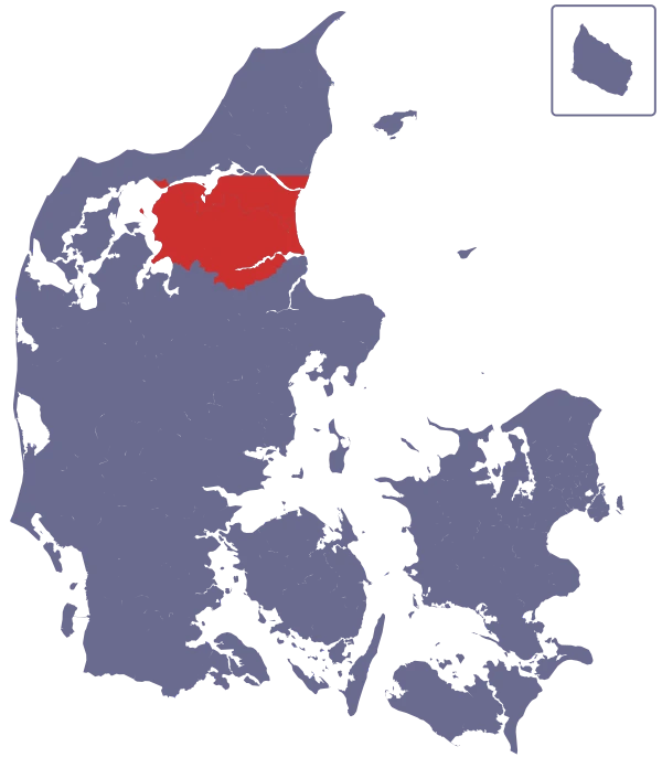 Rest of North Jutland |
West to east: 36 38 29 35 28 37 23 32 18 27 21 |
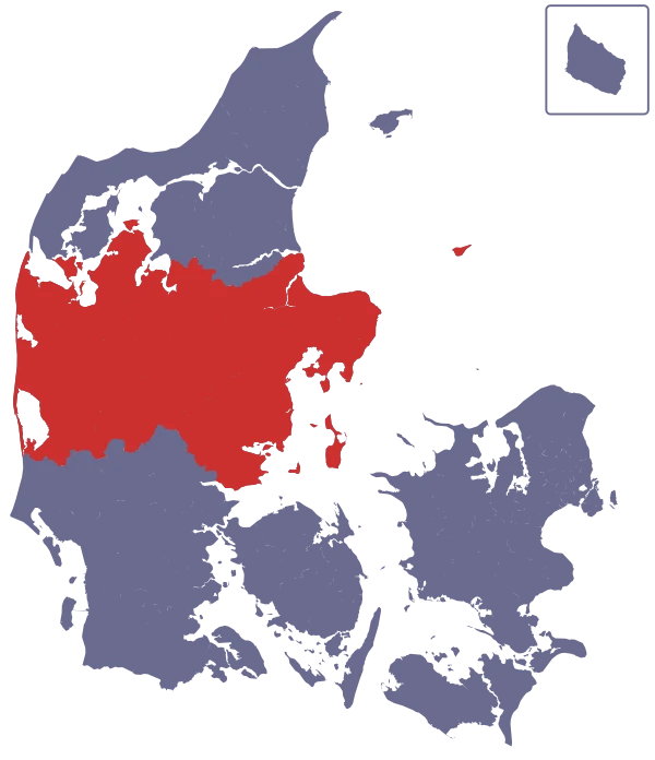 Central Jutland |
West to east: 17 16 24 18 32 53 20 21 23 25 35 33 31 30 21 53 29 11 16 51 15 7 8 87 14 18 27 9 3 22 20 On Samsø: 34 35 |
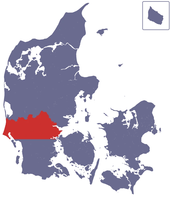 South Jutland north of Esbjerg–Kolding |
West to east: 10 2 8 9 7 23 36 34 35 62 32 33 37 55 53 58 57 |
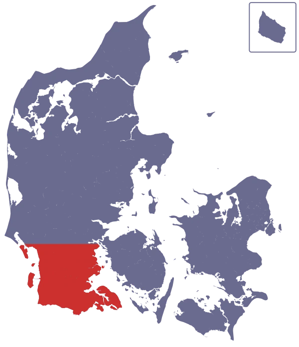 South Jutland south of Esbjerg–Kolding |
West to east: 2 10 11 4 6 9 19 12 64 35 7 10 37 |
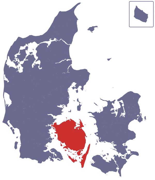 Funen, Langeland and Ærø |
Ærø: 91 92 Langeland: 80 81 82 83 Funen from Middelfart, anticlockwise around the island: 70 71 75 65 79 55 51 27 45 41 32 31 35 |
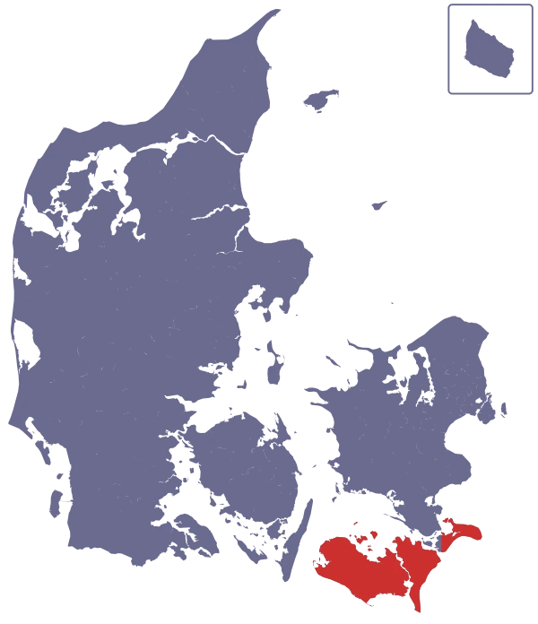 Lolland, Falster and Møn |
West to east: 89 35 38 88 40 49 45 58 |
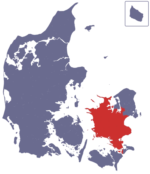 Rest of Zealand |
West to east: 27 50 44 40 88 52 54 90 56 85 58 86 |
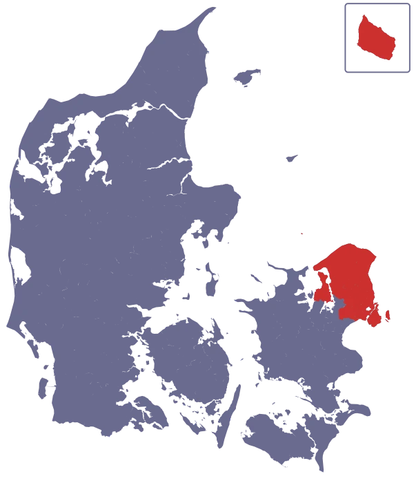 Capital Region |
North to south: 47 33 48 32 36 31 40 52 73 60 50 53 85 69 51 57 65 67 62 58 70 80 On Bornholm: 21 22 23 24 25 26 |
The map below shows all the regional routes, in groups by number. The line under each number in the list is its group’s colour. Pick a group to see where the routes are.
- Central Jutland: 3, 7, 8, 9
- South Jutland north of Esbjerg–Kolding: 2, 7, 8, 9
- South Jutland south of Esbjerg–Kolding: 2, 4, 6, 7, 9
- North of the Limfjord: 17, 19
- Rest of North Jutland: 18
- Central Jutland: 11, 14, 15, 16, 17, 18
- South Jutland north of Esbjerg–Kolding: 10
- South Jutland south of Esbjerg–Kolding: 10, 11, 12, 19
- North of the Limfjord: 23, 24
- Rest of North Jutland: 21, 23, 27, 28, 29
- Central Jutland: 20, 21, 22, 23, 24, 25, 27, 29
- South Jutland north of Esbjerg–Kolding: 23
- Funen, Langeland and Ærø: 27
- Rest of Zealand: 27
- Bornholm: 21, 22, 23, 24, 25, 26
- Rest of North Jutland: 32, 35, 36, 37, 38
- Central Jutland: 30, 31, 32, 33, 34, 35
- South Jutland north of Esbjerg–Kolding: 32, 33, 34, 35, 36, 37
- South Jutland south of Esbjerg–Kolding: 35, 37
- Funen, Langeland and Ærø: 31, 32, 35
- Lolland, Falster and Møn: 35, 38
- Capital Region: 31, 32, 33, 36
- Funen, Langeland and Ærø: 41, 45
- Lolland, Falster and Møn: 40, 45, 49
- Rest of Zealand: 40, 44
- Capital Region: 40, 47, 48
- North of the Limfjord: 52, 56, 59
- Central Jutland: 51, 53
- South Jutland north of Esbjerg–Kolding: 53, 55, 57, 58
- Funen, Langeland and Ærø: 51, 55
- Lolland, Falster and Møn: 58
- Rest of Zealand: 50, 52, 54, 56, 58
- Capital Region: 50, 51, 52, 53, 57, 58
- North of the Limfjord: 60, 61, 62, 63
- South Jutland north of Esbjerg–Kolding: 62
- South Jutland south of Esbjerg–Kolding: 64
- Funen, Langeland and Ærø: 65
- Capital Region: 60, 62, 65, 67, 69
- Funen, Langeland and Ærø: 70, 71, 75, 79
- Capital Region: 70, 73
- Central Jutland: 87
- Funen, Langeland and Ærø: 80, 81, 82, 83
- Lolland, Falster and Møn: 88, 89
- Rest of Zealand: 85, 86, 88
- Capital Region: 80, 85
- Funen, Langeland and Ærø: 91, 92
- Rest of Zealand: 90
The most useful thing to take away from this is that the numbers clump together in certain areas:
- A lot of the low numbers are in South Jutland, but not all.
- Region Midtjylland has a lot of numbers under 40.
- 35, 45, 55, 65 and 75 all go out from Odense, in clockwise order.
- Bornholm has all the numbers from 21 to 26, and they follow a system; see the section on Bornholm.
Watch out for local routes: many municipalities have their own routes, with numbers that can look like the regional ones. So a number on a cycle route sign is not always a regional route.
Links
- All the national routes, with a map
- Wikipedia on the national cycle routes (Danish)
- OpenCycleMap: a map with all the cycle routes in Denmark
- Many of the regional routes described individually
- The panorama routes on a map: change the number at the end of the address to see another route
- The Supercykelstier in the Copenhagen area and their exact paths
The maps are drawn from OpenStreetMap (© OpenStreetMap contributors), except panorama route 419, which is drawn after OpdagDanmark.